

Officially measured
bathing permitted
Last sample: 24 August 2026
Calculated for today
Weak signal today
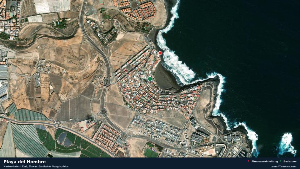
Reason: discharge 233 m away, not authorised, slight contamination possible.
233 metres away, Aliviadero EBAR Playa del Hombre I discharges into the sea, carrying domestic waste water. The register lists no permit for it. Before that, treatment is limited to screening and sieving. The register describes the condition of the pipe as poor (Precario).
Official sample
| E. coli | 4 | Limit 500 |
|---|---|---|
| Intestinal enterococci | 3 | Limit 185 |
| Official verdict | bathing permitted (Zona Apta para el baño) | |
| Annual class | excellent (EXCELENTE) | |
This sample was taken on 24 August 2026, so for today it is only an indication. This zone is sampled about every 20 days, the next sample was expected on 13 September 2026.
Conditions today
| Rain over the past 48 hours | 0.0 mm |
|---|---|
| Current | 0.7 km/h |
| Wave height | 1.14 m |
Waste water discharges nearby
| Waste water discharges nearby | Distance | Official verdict | Treatment | Condition of the pipe |
|---|---|---|---|---|
| Aliviadero EBAR Playa del Hombre I | 233 m | not authorised | screening only | poor |
| Emisario submarino de Hoya del Pozo (EDAR Hoya del Pozo) | 403 m | not authorised | secondary treatment | poor |
| Aliviadero EBAR Playa del Hombre II | 412 m | not authorised | screening only | bad |
| Cultivos Marinos | 825 m | pending | no data | good |
| La Ballena | 835 m | pending | no data | no data |
| Banco Español de Algas (BEA) | 957 m | not authorised | no data | good |
| Excedentes de los depósitos de agua de mar del Banco Español de Algas | 975 m | not authorised | no data | good |
| Emisario Submarino EBAR Garita III | 1.2 km | authorised | screening only | poor |
History
61 samples since 25 January 2023, 0 of them with a ban or warning.
Why this page exists
This page exists because a waste water outlet discharges into the sea 233 metres away. The measurement series for this zone has been unremarkable so far.
Official bathing water profile (PDF)
The map needs JavaScript. All readings are in the tables on this page as well.
Beaches nearby
All bathing zones on Gran Canaria To the map of all Canary Islands
This page does not replace official bathing water monitoring or a warning issued by the municipality. The estimated part is our own calculation, not a measurement.
Sources: Gobierno de Canarias (Dirección General de Salud Pública; Censo de vertidos desde tierra al mar), Ministerio de Sanidad (NÁYADE), European Environment Agency (UWWTD), Ministerio para la Transición Ecológica, Open-Meteo. Data as of: 2026-09-13, 22:49