The map needs JavaScript. All readings are in the tables on this page as well.
8 Bathing zones 5 with a finding 1 zones with an active discharge under 250 m 1 zones with a history of bans All official bathing zones, by municipality Beaches in Breña Alta Bathing zone Annual class Most recent sample E. coli / enterococci Nearest active discharge Playa de Bajamar excellent 2026-10-19 43 / 2 486 Meter
Beaches in Breña Baja Bathing zone Annual class Most recent sample E. coli / enterococci Nearest active discharge Playa de los Cancajos excellent 2026-10-19 1 / 2 957 Meter
Beaches in Los Llanos de Aridane Beaches in San Andrés y Sauces Beaches in Santa Cruz de la Palma Beaches in Tazacorte Bathing zone Annual class Most recent sample E. coli / enterococci Nearest active discharge Playa de El Puerto de Tazacorte excellent 2026-10-19 1 / 1 1.2 Kilometer
Where an active discharge lies closer than 250 metres Bathing zone Waste water discharges nearby Distance Official verdict Playa de Puerto Espíndola Emisario submarino de Puerto Espíndola 96 Meter not authorised
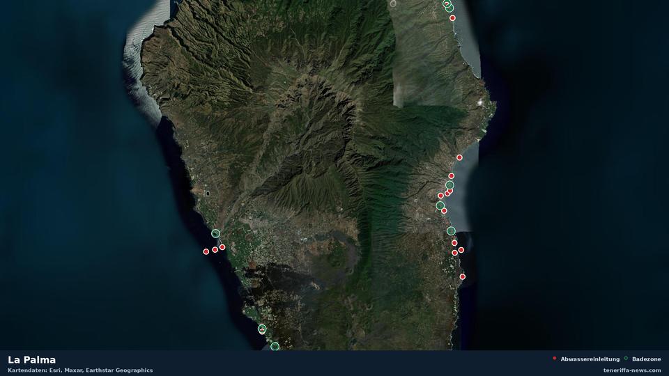
Zones with a history of bans Where the official sample is overdue Satellite map of La Palma with 8 official bathing zones and 17 wastewater outfalls Map data: Esri, Maxar, Earthstar Geographics. To the map of all Canary Islands
Waste water news from the Canary Islands This page does not replace official bathing water monitoring or a warning issued by the municipality. The estimated part is our own calculation, not a measurement.
Sources: Gobierno de Canarias (Dirección General de Salud Pública; Censo de vertidos desde tierra al mar), Ministerio de Sanidad (NÁYADE), European Environment Agency (UWWTD), Ministerio para la Transición Ecológica, Open-Meteo. Data as of: 2026-10-29, 00:22
How the rating is calculated