

Data as of: 2026-09-19, 11:48
Officially measured
bathing permitted
Most recent sample: 7 September 2026
Our calculation
Some concern today
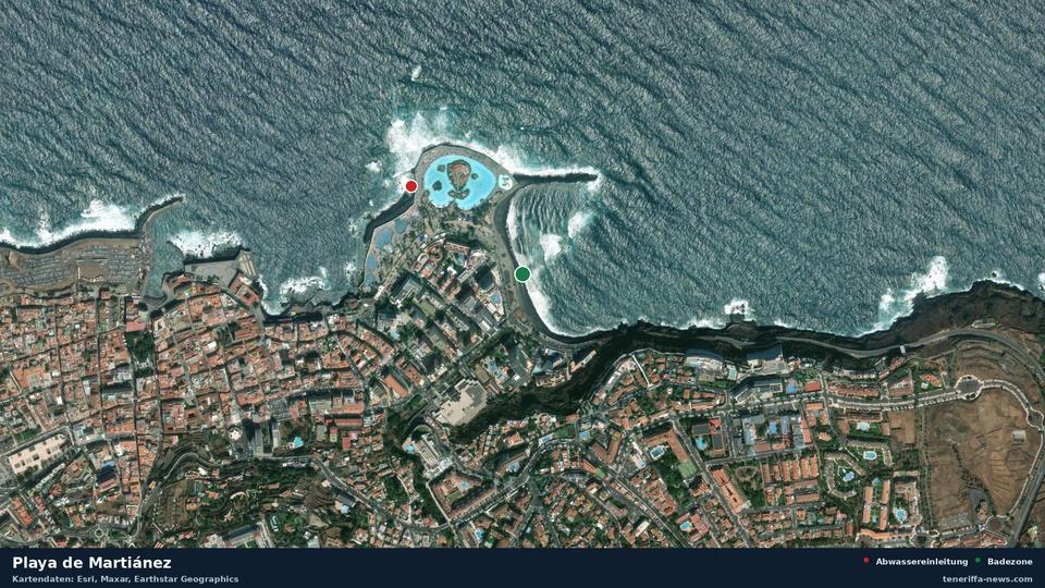
Reason: waste water discharge 380 metres away, not authorised, slight contamination possible. Please observe any signage on site.
* Calculated from rain, live data on ocean currents and the zone own sample series. Updated hourly.
Playa de Martiánez is situated in Puerto de la Cruz on Tenerife. The seabed consists of pebbles and dark sand. Activities reported in the area include bodyboarding, kitesurfing, diving and boules. At around 350 metres long and approximately 25 metres wide, the beach is larger than the average for Tenerife's bathing areas.
Most recent official sample
| E. coli | 9 | Limit 500 |
|---|---|---|
| Intestinal enterococci | 29 | Limit 185 |
| Official verdict | bathing permitted (Zona Apta para el baño) | |
| Annual class | excellent (EXCELENTE) | |
The most recent sample was taken on 7 September 2026. For conditions today it is only an indication. This zone is sampled about every 21 days, and by that rhythm the next sample is due on 28 September 2026.
Conditions today
| Rain over the past 48 hours | 7.2 millimetres |
|---|---|
| Current | 0.4 km/h |
| Wave height | 1.68 metres |
Waste water discharges nearby
| Waste water discharges nearby | Distance | Official verdict | Treatment | Condition of the pipe |
|---|---|---|---|---|
| Desagüe Piscinas Lago Martiánez C (El Lago) | 341 Meter | not authorised | no data | good |
| Desagüe Piscinas Lago Martiánez B (Alisios + Pulpo) | 369 Meter | not authorised | no data | good |
| Rebosaderos Piscinas Lago Martiánez | 380 Meter | not authorised | no data | good |
| Desagüe Piscinas Lago Martiánez A (Barco + Climatizada + San Telmo + Jacuzzi) | 383 Meter | not authorised | no data | good |
| Aliviadero EBAR San Telmo | 590 Meter | not authorised | screening only | good |
| Pluviales de la descarga de la red unitaria en la zona del casco | 869 Meter | authorised | screening only | no data |
| Aliviadero EBAR Playa Jardín | 1.8 Kilometer | not authorised | screening only | bad |
| Aliviadero EBAR Playa Chica | 2.4 Kilometer | not authorised | no data | good |
History
58 samples since 23 January 2023, none of them with a ban or warning.
This page exists because a waste water outlet discharges into the sea 341 metres away. The measurement series for this zone has been unremarkable so far.
Official bathing water profile (PDF)
The map needs JavaScript. All readings are in the tables on this page as well.
Beaches nearby
Weather in Puerto de la Cruz: current forecast, water temperature and UV index
All bathing zones on Tenerife To the map of all Canary Islands
Waste water news from the Canary Islands
This page does not replace official bathing water monitoring or a warning issued by the municipality. The estimated part is our own calculation, not a measurement.
Sources: Gobierno de Canarias (Dirección General de Salud Pública; Censo de vertidos desde tierra al mar), Ministerio de Sanidad (NÁYADE), European Environment Agency (UWWTD), Ministerio para la Transición Ecológica, Open-Meteo.