

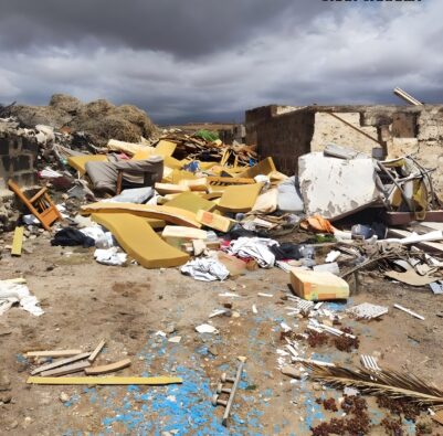
The litter map for Fuerteventura lists all verified litter reports submitted by our readers on Fuerteventura. The island’s municipalities are colour-coded according to their litter index: the darker the area, the more litter reported per inhabitant has been found.
- 0spots on the map
- 0reports in 12 months
- 0of which cleared
- 0reports since launch
The municipalities on Fuerteventura
| Rank | Municipality | Rubbish index | Reports | active | cleared | Last month |
|---|---|---|---|---|---|---|
| Antigua (not enough reports yet) | 0 | 0 | ||||
| Betancuria (not enough reports yet) | 0 | 0 | ||||
| La Oliva (not enough reports yet) | 0 | 0 | ||||
| Puerto del Rosario (not enough reports yet) | 0 | 0 | ||||
| Pájara (not enough reports yet) | 0 | 0 | ||||
| Tuineje (not enough reports yet) | 0 | 0 |
No municipality has enough reports for a ranking yet.
The ranking counts reports from our readers, checked by photo. It is not an official survey. Rubbish index: weighted reports over the last twelve months per 10,000 inhabitants (small 1, medium 3, large 8). A municipality is ranked from five reports, an island from 20. Cleared spots still count, because the rubbish was there.
Municipal boundaries: Gobierno de Canarias (GRAFCAN, CC BY 3.0, 2021). Population: INE, 1 January 2025. Updated: 29 September 2026, 12:02
Rubbish map of the other islands
How the litter map for Fuerteventura works
Anyone reporting litter on Fuerteventura simply taps the button, then taps the map, uploads a photo and confirms the report by email. An image verification process filters out photos without litter and blurs out people and number plates. The email address is never visible to others; it is used solely for confirmation purposes.
Once the rubbish has been cleared away, this can be confirmed by taking a new photo. The location where it was found is then highlighted in green and remains visible for 90 days. Points that have not been confirmed by anyone for six months disappear from our Fuerteventura rubbish map.