

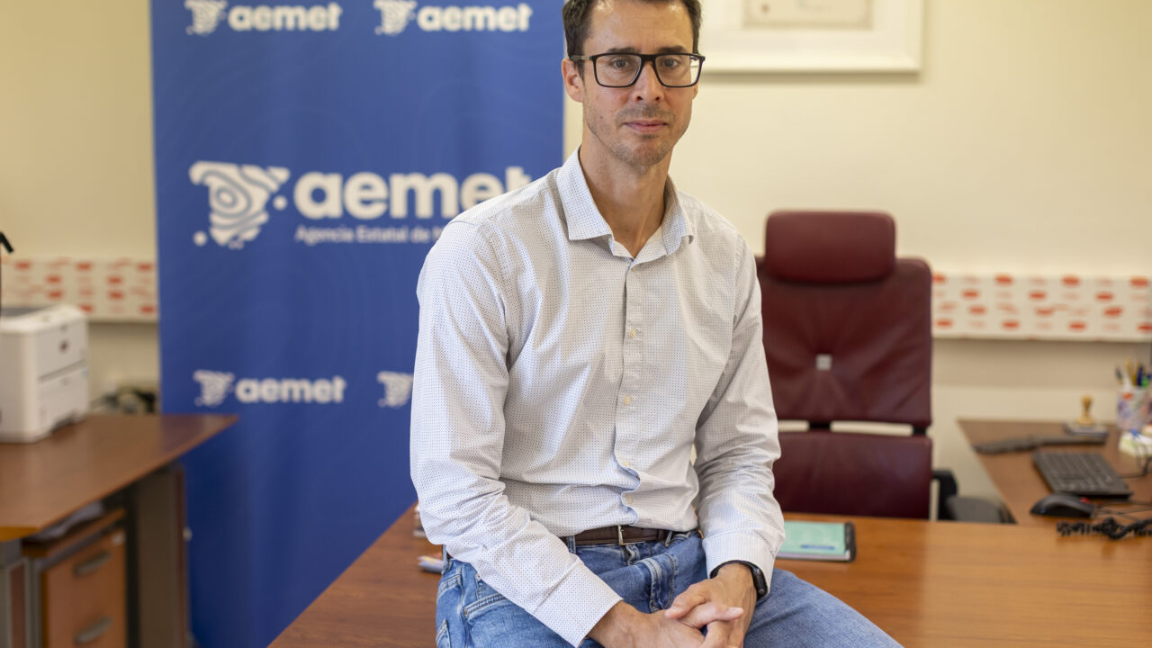
On the night of 7-8 November 1826, one of the worst natural disasters ever recorded in the Canary Islands took place: a storm that claimed 298 lives. Two centuries later, David Suárez, the AEMET representative for the archipelago, wonders how a similar event would be dealt with, given that it would have a much greater impact on islands that are now much more densely populated.
The severe storm, which would go down in history as the ‚Flood of 1826‘, affected Tenerife and Gran Canaria but caused greater devastation on the former, where, in addition to the loss of life, it destroyed some 650 homes and led to the loss of the original statue of the Virgin of Candelaria, the island’s patron saint.
Canary Islands: Meteorological service reviews contingency plans for extreme weather
With the bicentenary just days away, the regional representative of the State Meteorological Agency speaks in an interview with EFE about extreme weather events in the archipelago and about «how we prepare for a situation that may prove challenging, how we organise ourselves and what staff we have available to deal with this sort of event».
«It’s about looking at ‚how we work now to convey information not only about the phenomenon, but also to trigger an early warning system to minimise the impact, because the primary objective is to ensure there are no casualties‘,» reflects the meteorologist.
The flood of 1826 may have had tropical origins
The Flood of 1826 occurred in a pre-instrumental era, even before the founding of the National Meteorological Service in 1877; consequently, there are no scientific records of the event apart from those from a barometer, as there was no monitoring system as such.
Contemporary accounts and subsequent studies indicate that a drop in pressure was recorded and that it may have been a system of tropical origin, based on indirect evidence such as the geomorphological and sedimentary traces left by the runoff; furthermore, one contemporary observer with previous experience in the Caribbean referred to a rapid drop in barometric pressure; that is, a cyclogenesis.
This is a plausible hypothesis, given that the Atlantic tropical cyclone season runs from 1 June to 30 November and peaks between the second half of September and the first half of October, explains Suárez.
Recent examples of how, if tropical conditions are favourable, such storms can veer off course and reach the Canary Islands include ‚Delta‘ in November 2005 and ‚Hermine‘ in September 2022.
However, the AEMET’s regional representative points out that it is impossible to know for certain whether the Flood of 1826 was a tropical cyclone; nevertheless, he adds, what seems clear is that it was a very significant event for the Canary Islands given the number of casualties.
Dense coastal development today increases the risks
«And if we look at it from today’s perspective, the question that remains is: what impact would a system of that nature have today, given current technological, informational and administrative advances?», he asks.
«How would we classify it today, given the rainfall figures and with greater exposure and much higher vulnerability, with overpopulated coastal areas, more heavily used infrastructure and roads full of traffic?» he continues in his reflection.
The red alert is based on specific weather data
From a scientific perspective, it is necessary to understand the nature of the weather system that is going to have an impact; and from a civil protection perspective, the potential impact must be analysed, and in this regard, it makes no difference whether it is a storm or a tropical cyclone; the decisive factor is whether there will be wind gusts exceeding 120 kilometres per hour and rainfall in excess of 60 litres per square metre in one hour; that is to say, the factors that indicate a red warning.
The impact is determined by the areas that will be affected by the event and the timeframe in which it is set to occur; this establishes the most likely scenario, and on that basis a series of decisions are taken which must be communicated ‚very clearly‘ to the various authorities, explains the head of the AEMET in the Canary Islands.
«This system has improved considerably over the last 20 years,» continues David Suárez, adding that meteorology has advanced «but it is not an exact science» and that situations still arise «which can take us by surprise and which require us to work on, for example, protocols for rapid decision-making».
This is because, whilst issuing a red warning 48 or 72 hours in advance allows time to make plans, a cyclone or storm may subsequently experience ‚intensifications linked to the development of small-scale structures‘ that have a greater impact at a local level, as was the case with ‚Therese‘.
However, the AEMET’s regional representative points out that a tropical cyclone «does not appear out of nowhere» and adds that, even before it forms, «it is already being monitored».


Comments (0)
No comments on this article yet.