

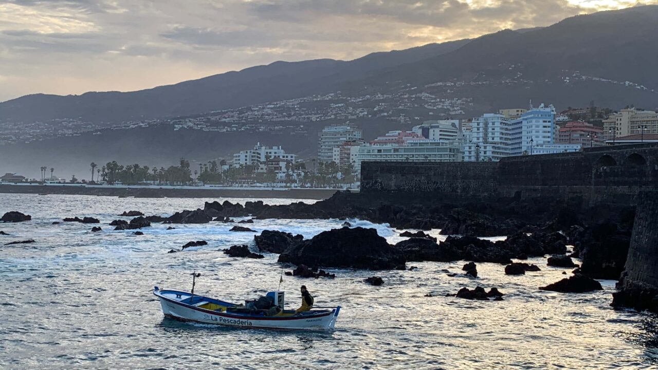
This article is more than just a travel guide. We provide a detailed introduction to Puerto de la Cruz on Tenerife and everything there is to discover and experience around this town in the north of the island. The town is one of the most popular destinations in the north of the island and offers numerous attractions, short distances between places and a lively old town. Even ‚old hands‘ will find some new information below.
Top sights in Puerto de la Cruz
To help you find your way around straight away, here’s a quick list of the highlights. Just click to go straight to the relevant section in our travel guide below.
Puerto de la Cruz Travel Guide
Puerto de la Cruz, or ‚Puerto‘ for short, is the tourist centre in the north of Tenerife. The town itself has a population of around 30,500, making it only the eighth-largest on the island. However, among Tenerife’s larger towns, Puerto also has the smallest area, making it one of the most densely populated on the island. Thanks in part to its large catchment area, which includes La Orotava and Los Realejos, Puerto is, taken as a whole, the third-largest metropolitan area in Tenerife. Yet the municipality itself, covering just 8.73 square kilometres, is actually the smallest of all the Canary Islands!
Below you will find – organised into several chapters – everything you need to know about the town and its sights. At the end of this article, you will find further links to even more important places, sights and information about Puerto de la Cruz.
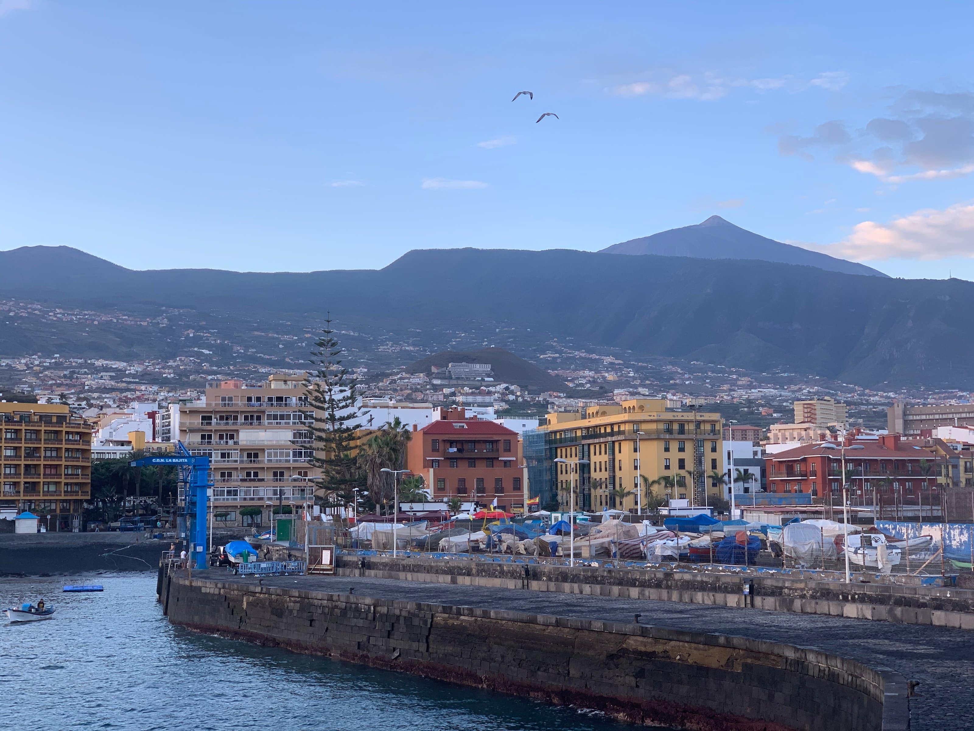
If one includes the Orotava Valley around La Orotava and Los Realejos, Puerto de la Cruz forms a conurbation with a population of around 110,000. The town lies south-west of the capital, Santa Cruz. The two towns are linked by the TF-5 motorway. Some travel guides still use other designations, as the motorway numbering system on Tenerife has been revised; however, TF-5 is the currently valid designation.
Around 32,000 beds await visitors to Puerto. However, over the years, the occupancy rate has fallen below 50 per cent in some months. The town has been struggling for years with fierce competition from the south of the island. Furthermore, Puerto was labelled a ‚retirees‘ paradise‘ many years ago, a fact that was recognised too late as a marketing problem – and which does not do the town justice.
Puerto’s biggest problem, however, was the city’s decline, which had gone unrecognised for many years. Since 2010, when many hotels were forced to close in the wake of the tourism crisis, efforts have been gradually made to rectify these shortcomings. The city has been undergoing a transformation ever since, and the splendour of days gone by is being restored street by street. The regeneration and modernisation measures – particularly at the higher-end hotels such as the Hotel Botanico in La Paz – have long since begun to bear fruit. Occupancy rates are rising, as is visitor satisfaction, and many streets have now been modernised.
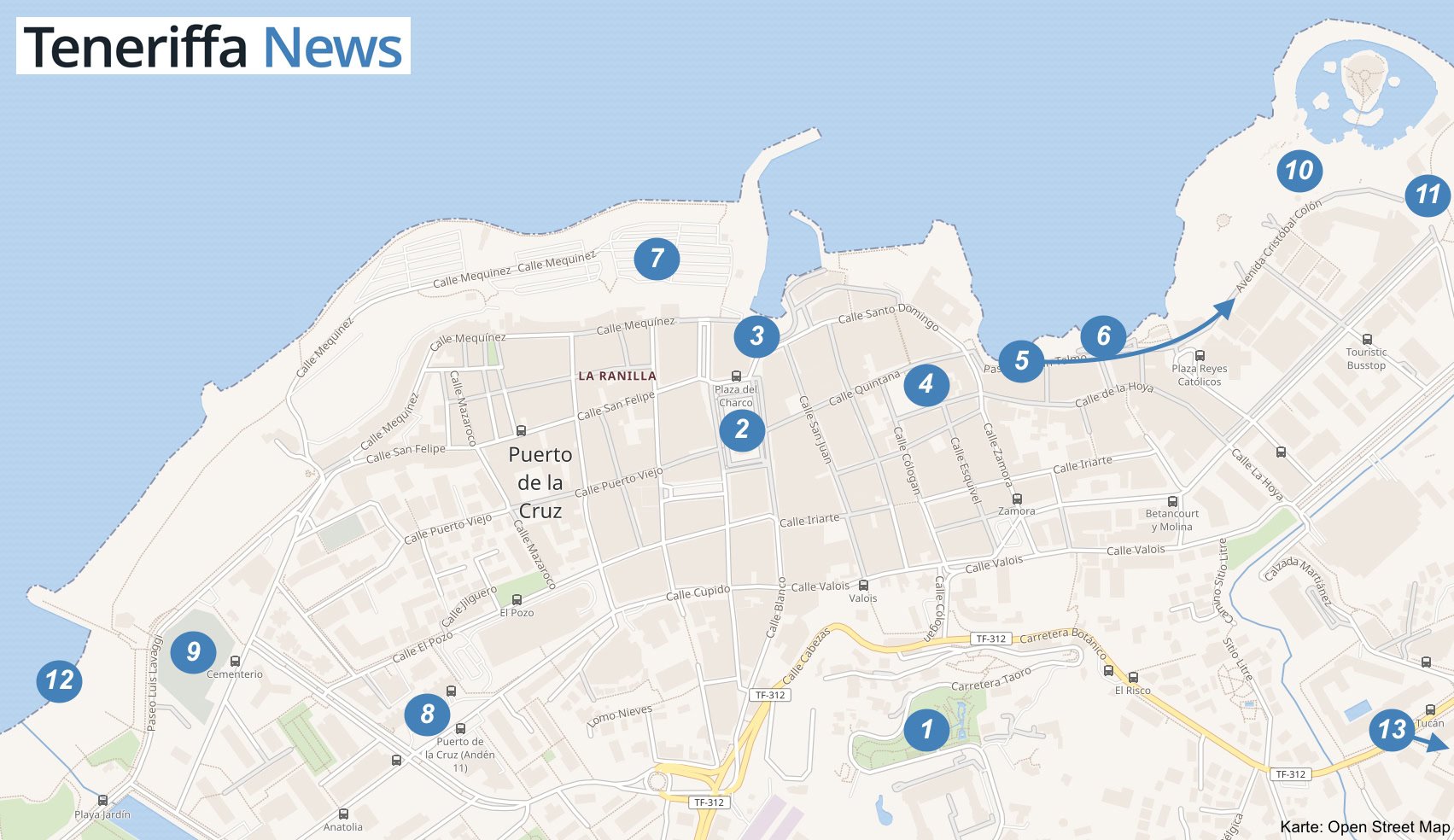
Map: City map with attractions
The numbers on our map will help guide you when looking for places of interest. In the following chapters, you will regularly find references to which number corresponds to each place of interest:
Guided Tours of Puerto de la Cruz
The history of Puerto de la Cruz on Tenerife
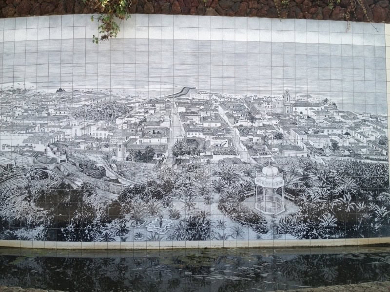
The very name of the town reveals a great deal about its history. As the port for the town of La Orotava, situated at an altitude of around 300 metres, Puerto de la Cruz grew to become a strategically important location on Tenerife. European merchants preferred to stay in the higher reaches of the Orotava Valley, where they were somewhat better protected from the weather and attacks from the sea, but needed the port for their trade.
This situation brought Puerto de la Cruz not only fame but also financial benefits. Whilst the more magnificent houses and villas are still to be found in La Orotava, the bustling trade helped to develop the harbour and the town into what Puerto is today.
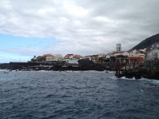
Although Puerto de la Cruz has always had a smaller harbour than nearby Garachico, its location, with a hinterland that was of greater interest first for agriculture and later for tourism, has always been a major advantage for what is now a major city. When Garachico’s harbour was completely buried during a volcanic eruption in 1706, Puerto de la Cruz definitively took over the leading role in shipping on and around Tenerife.
However, it was not until much later, with the rise of tourism in the 1950s, that Puerto de la Cruz truly became separate from its parent town. Since then, the harbour has become more or less insignificant. Plans to open a new marina and fishing harbour have, however, been in the works for decades.
Tip: Travel insurance for Tenerife
By the way: if you’d like to travel to Tenerife safely and with peace of mind, we have the perfect offer for you. Take a look here at the Tenerife News travel insurance for the Canary Islands.
Location and climate of Puerto de La Cruz

Thanks to Puerto’s geographical location, conditions are ideal for thousands of plant species. Situated at the foot of the Orotava Valley, the town benefits from the lush greenery of the slopes and its location right on the Atlantic coast. Furthermore, from December to April, there is regularly an unobstructed view of Mount Teide – which is often covered in snow at that time – at least in the mornings.
This is also why the Tenerife Botanical Garden is situated in Puerto de la Cruz (more on this below). The mountains surrounding Mount Teide ensure that a large trade wind cloud forms over the Orotava Valley during the day, keeping the climate quite humid. Combined with the strong sunshine, this sometimes creates tropical conditions. However, a constant light breeze makes this bearable even for people who have only just arrived and have not yet acclimatised.
Thanks to the light breeze and the trade wind cloud, it doesn’t get too hot in summer. As a result, temperatures in Puerto de la Cruz are quite pleasant all year round. You can find detailed information on the weather and climate in Tenerife here.
Weather in Puerto de la Cruz
The sky above Puerto de la Cruz is often covered with thin clouds. Nevertheless, the weather is usually fine. However, it is not entirely consistent, as you can read in the section on the town’s climate above You can see exactly how the weather in Puerto de la Cruz is set to develop in our weather forecast here under ‚Weather in North Tenerife‘.
Botanical Gardens in Puerto de la Cruz
(You can find the Botanical Garden on our map of Puerto de la Cruz under number 13.)
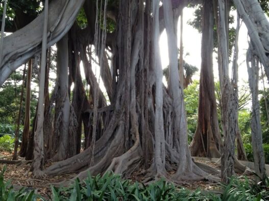
There’s a good reason why Puerto de la Cruz is so green: the climate at the foot of the Orotava Valley creates conditions in which countless plant species thrive. The Botanical Gardens are probably the most obvious example of this and are therefore a must-see for many visitors to the town.
Anyone who takes the time to explore it will soon realise why this place has been one of the classic attractions in Puerto de la Cruz for decades. It offers a peaceful contrast to the town and, on hot days, is also a pleasant place to take a breather.
Further information: You can find the full article here: Botanical Garden, Jardín Botánico.
Tourism development in Puerto de la Cruz
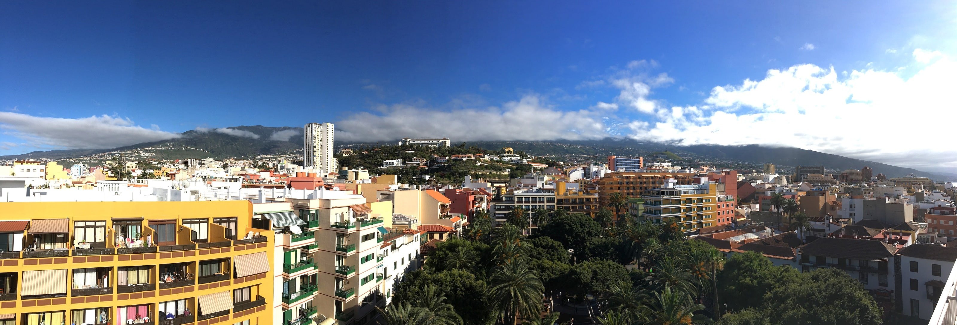
The first tourists arrived in Tenerife at the end of the 19th century. Banana ships brought package holidaymakers to Puerto de la Cruz for two-week stays. Word spread via maritime trade routes that Tenerife’s climate was particularly healthy and that the locals were very laid-back people. Moreover, a great deal of information about the island had already become known long before that, thanks to scientists and adventurers such as Alexander von Humboldt.
The growth in maritime trade eventually paved the way for the first journeys to Tenerife with a completely new purpose. The Tinerfeños – as the inhabitants of Tenerife are known – quickly recognised a business opportunity in these early travellers, who were not crossing the sea for trade or, indeed, conquest. Thus, in 1892, Spain’s first hotel, the ‚Grand Hotel Taoro‘, was opened thanks to predominantly English capital.
However, Puerto’s real breakthrough as a tourist hub on Tenerife only came with the advent of affordable air travel in the early 1950s. The construction boom that lasted well into the 2000s finally began in the 1960s.
The first tourist bunkers were built near the coast, but mainly on the agricultural land surrounding the town. The island’s residents, most of whom were poor, recognised a more lucrative line of business than the arduous work of farming had ever been. As a result, much of the activity in and around Puerto de la Cruz suddenly centred solely on tourism.
Taoro Park: Where it all began for Puerto de la Cruz
(You can find Taoro Park on our map of Puerto de la Cruz under number 1.)
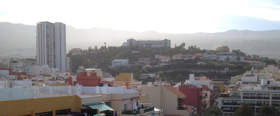
Taoro Park is situated high above the centre of Puerto de la Cruz. The park as it stands today was once the garden of the town’s first hotel. The Grand Hotel Taoro opened there in 1892. It was the largest hotel complex in the whole of Spain. It was financed largely with English capital.
In its day, the hotel attracted the European aristocracy. Hot and cold running water and electricity, as well as the lovingly tended garden, were all standard features. However, the hotel burnt down completely in 1929. Despite being rebuilt swiftly, it never regained the splendour of its former days.
Later, the town’s casino opened in Taoro Park, but for strategic reasons it moved to Lago Martianez, the large swimming pool on the promenade.
It is well worth visiting the park today, which remains well-maintained. It can be accessed via an entrance at the foot of the ‚Bel Air‘, the tallest building in Puerto, standing 24 storeys high, whose sheer massiveness serves as a symbol of the unchecked building boom of years gone by.
From there, you can make your way uphill through the park towards the Taoro. At the top of the park, visitors will find not only the Taoro Hotel itself but also a restaurant. Whether you’re after a quick coffee or a full meal, the value for money is excellent, the food is good and, ultimately, the view over the city more than makes up for the strenuous climb.
Taoro Hotel has reopened
In 2013, a restoration plan for the historic Taoro Hotel was approved. The Island Council had announced in February 2012 that it intended to launch a tender. The aim was to revitalise the hotel. This has now been achieved: the hotel has reopened as a luxury hotel meeting five-star standards. You can find pictures of the refurbishment here.
The 1970s: New construction projects for Puerto de la Cruz
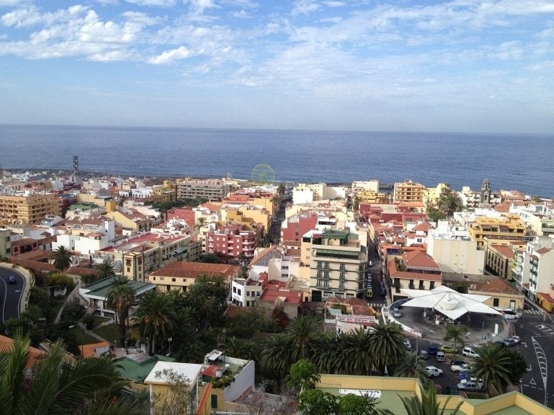
As more and more hotels and other tourist facilities were built, Puerto de la Cruz reached a natural territorial limit. Consequently, tourism shifted further and further south across Tenerife. The desert landscape there offered investors affordable plots of land. In this way, the enormous success of the north itself gave rise to the competition we see today from the sun-drenched southern part of the Canary Islands.
Recognising this problem, the local council began to create attractions through new construction projects. This led to the creation in the 1970s of the two beaches, Playa Jardín in the west and Playa Martianez, as well as the Martianez seawater swimming pool in the east of the town. (You can find the outdoor swimming pool on our map of Puerto de la Cruz, marked with the number 10.)
However, the ongoing construction boom also brought major drawbacks for Puerto de la Cruz: the layout of the roads became increasingly confusing. More and more one-way streets led to persistent traffic chaos. The once-narrow alleyways became less and less inviting for a stroll, and so it was hardly any fun at all to walk through the town as a pedestrian.
It was not until the 1990s that pedestrianised areas and multi-storey car parks were built once again. However, new shopping centres then drew visitors away from the town centre to the outskirts. Once again, therefore, these changes did not entirely bring the success that had been hoped for.
Plaza del Charco – the heart of Puerto de la Cruz
(You can find the Plaza del Charco on our map of Puerto de la Cruz marked with the number 2.)
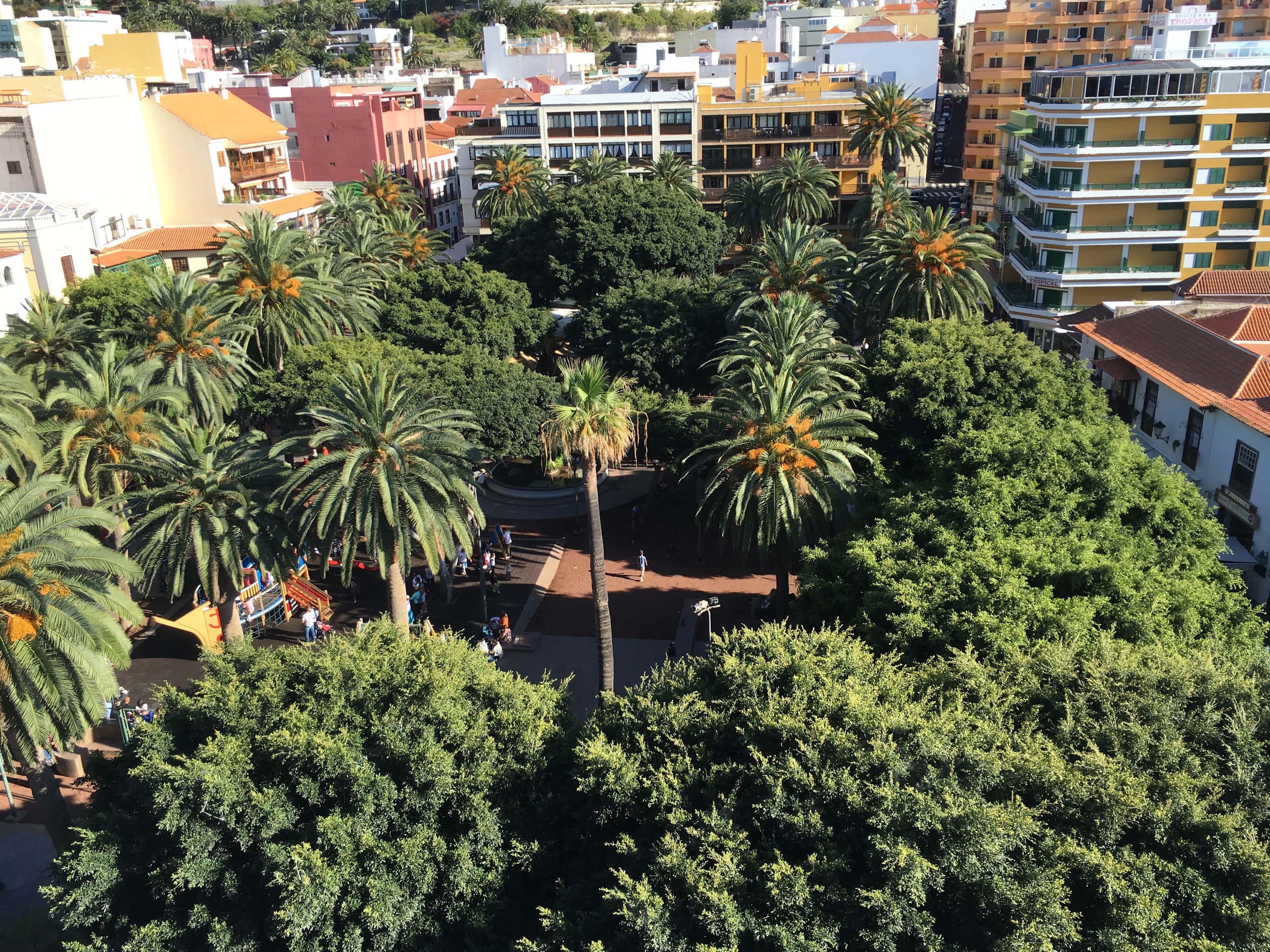
The Plaza del Charco is the heart and centre of Puerto de la Cruz. This square, arguably the town’s best-known, owes its name to its location, for historical reasons.
The Plaza del Charco was first planned in 1610 by Jerónimo Mines – at that time, it was intended purely as a landing stage for goods from ships moored in the harbour. As the square, situated directly behind the harbour, was regularly flooded by the tides, it soon became known locally as the ‚Charco de los Camarones‘, which translates as ’shrimp puddle‘.
After several name changes, the square was renamed ‚Plaza General Franco‘ following the victory of the Spanish fascists, in honour of their leader. It was not until 1976 that the local council finally restored the name that the town’s former residents had given it: Puerto de la Cruz finally had its ‚Plaza del Charco‘ back.
Today, the Plaza del Charco is lined with palm trees and old Indian laurel trees, as well as numerous restaurants and cafés, some of which date back as far as the 17th century.
Plaza del Charco – where life in Puerto de la Cruz unfolds
Whilst the adults read or simply relax on the park benches, dine in one of the surrounding restaurants or watch live football matches, many children make the most of the large playground in the centre. This was refurbished in the early 2010s and has been maintained by the local council ever since. A large climbing frame in the shape of a pirate ship, complete with swings and seesaws, keeps the little ones thoroughly entertained.
There are kiosks at each of the four corners of the square. On the south side, you can find newspapers and magazines from all over the world. The other stalls sell food, drinks and all sorts of bits and bobs, such as toys and souvenirs.
The Ñamera – more than just a fountain
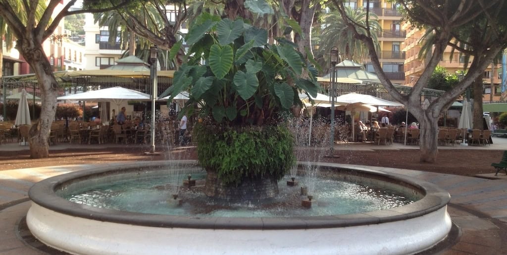
In the centre of the Plaza del Charco stands an old fountain, adorned in the centre by a special plant: the Ñamera. The locals hold this plant in high regard. The history of Puerto de la Cruz even includes poems about this plant.
From a botanical point of view, the Ñamera is a colocasia, also known as a taro or elephant’s ear. It belongs to the arum family and, just like the laurel trees lining the square, is native to India.
It is a popular ornamental plant because of its heart-shaped leaves, which can grow up to 70 centimetres wide. However, care should be taken with its tubers. They contain calcium oxalate, a substance that irritates the skin and can only be rendered harmless by boiling the tubers. For this reason, too, it is good that the Ñamera is surrounded by a fountain, which serves as a water feature in the afternoon and, during Advent, creates a festive atmosphere thanks to special lighting.
Seeing and being seen in the Plaza del Charco
To some extent, the principle of ’see and be seen‘ now applies in the square. Partly for this reason, but above all due to the rather extroverted way of life of the Canary Islands, children often play late into the night at weekends and during the holidays, whilst their parents are comfortably engrossed in conversation or reading their newspapers. The local residents have long since got used to the accompanying noise.
During Carnival, the Plaza del Charco is also der the meeting place and centre of the festivities. A large stage sets the mood, whilst numerous parades and samba groups repeatedly circle the plaza, attracting hundreds of visitors.
In addition, during Carnival, further stalls are set up offering Spanish and food and drink from the Canary Islands at very reasonable prices. As a result, there’s plenty going on at the Plaza del Charco on these days.
The harbour of Puerto de la Cruz
(You can find the harbour on our map of Puerto de la Cruz marked with the number 3.)

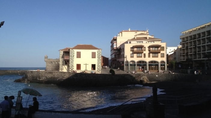
Puertos harbour is situated right in front of the Plaza del Charco. Today, it is used exclusively as a fishing harbour. Small boats set out from here to catch fresh fish, which is then sold at a small stall right by the harbour.
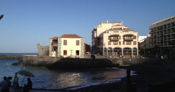
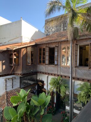
The Puertos harbour is also home to one of the town’s most famous houses, the «Casa Miranda». The house dates from 1730. It served as both a residence and a commercial premises. The double balcony facing the sea is typical of Canary Islands architecture.
Casa Miranda belonged to Francisco de Miranda’s father. He was a pioneer of Venezuelan independence. Austin Baillon, director of Shell International, bought the house in the 1960s, thereby saving Casa Miranda and the «Royal Customs House» from demolition. Today it houses a restaurant.
70 million euros: Puerto’s new harbour
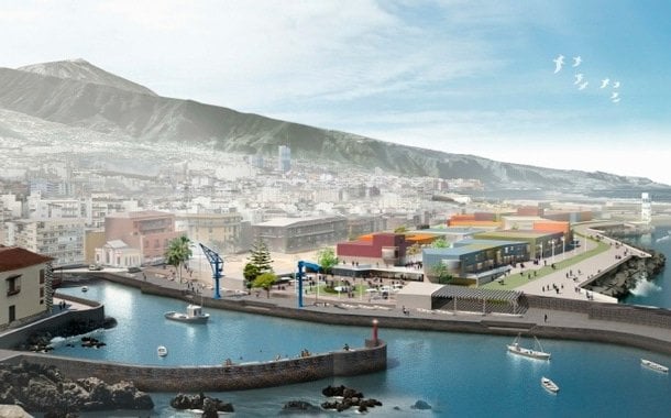
A major project is set to breathe new life into the port of Puerto de la Cruz: according to current plans, a group of investors from the Canary Islands led by local architect Fernando Menis is to build a new marina and sports harbour in Puerto de la Cruz. The new port is to be built right next to the old one.
For a staggering 70 million euros, 250 moorings for yachts and 50 jetties for local fishermen are to be built across an area of more than 340,000 square metres. Politicians hope the project will give a new boost to the town’s tourism and economy. However, as is customary in Tenerife and the Canary Islands, the planning process has already dragged on for many years and is now met with little more than a weary smile by most local residents. Detailed information on the harbour’s redevelopment can be found here.
Photos from Puerto de la Cruz
La Ranilla: The old town of Puerto de la Cruz
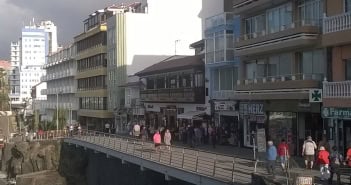
The La Ranilla district forms part of the historic old town of Puerto de la Cruz and is just a stone’s throw from the Plaza del Charco. As such, it is one of the oldest areas of the town and has undergone significant changes in recent years. Over the years, many of the narrow alleyways have been extensively renovated in some cases, building façades have been restored, and numerous new restaurants and bars have opened. There are also seating areas and planting.
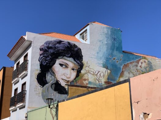
The street art in and around the old town of Puerto de la Cruz is particularly striking today. International artists have decorated numerous building façades. This has created a small open-air museum that visitors often stumble upon by chance as they stroll through the narrow streets around the old harbour.
If you really want to get to know Puerto de la Cruz, you should take some time out and simply stroll through the narrow streets of La Ranilla. Amidst old houses, little cafés and art on the walls, this area reveals a side of the town all of its own.
Find out more: You can find a detailed tour of the street art in Puerto de la Cruz here: Street Art in Puerto de la Cruz.
The church square in Puerto de la Cruz
(You can find the church square on our map of Puerto de la Cruz, marked with the number 4.)

Continuing from the harbour towards the promenade, the route takes you past the church square in Puerto de la Cruz. The Plaza de la Iglesia is situated directly on Calle Quintana. In front of the church is a small square where it’s well worth taking a break amongst the palm trees, flowers and a small swan fountain.
The «Nuestra Señora» Church in Puerto de la Cruz
The church of «Nuestra Señora de la Peña de Francia» was consecrated towards the end of the 17th century. However, it wasn’t until 1898 that it acquired its tower. The church is well worth a visit; the altar, in particular, is considered a magnificent highlight.
Behind the church is a small café where it’s well worth stopping for a break. You can find our ‚restaurant review‘ here.
The promenade in Puerto de la Cruz
(You’ll find the promenade on our map of Puerto de la Cruz marked with the number 5.)
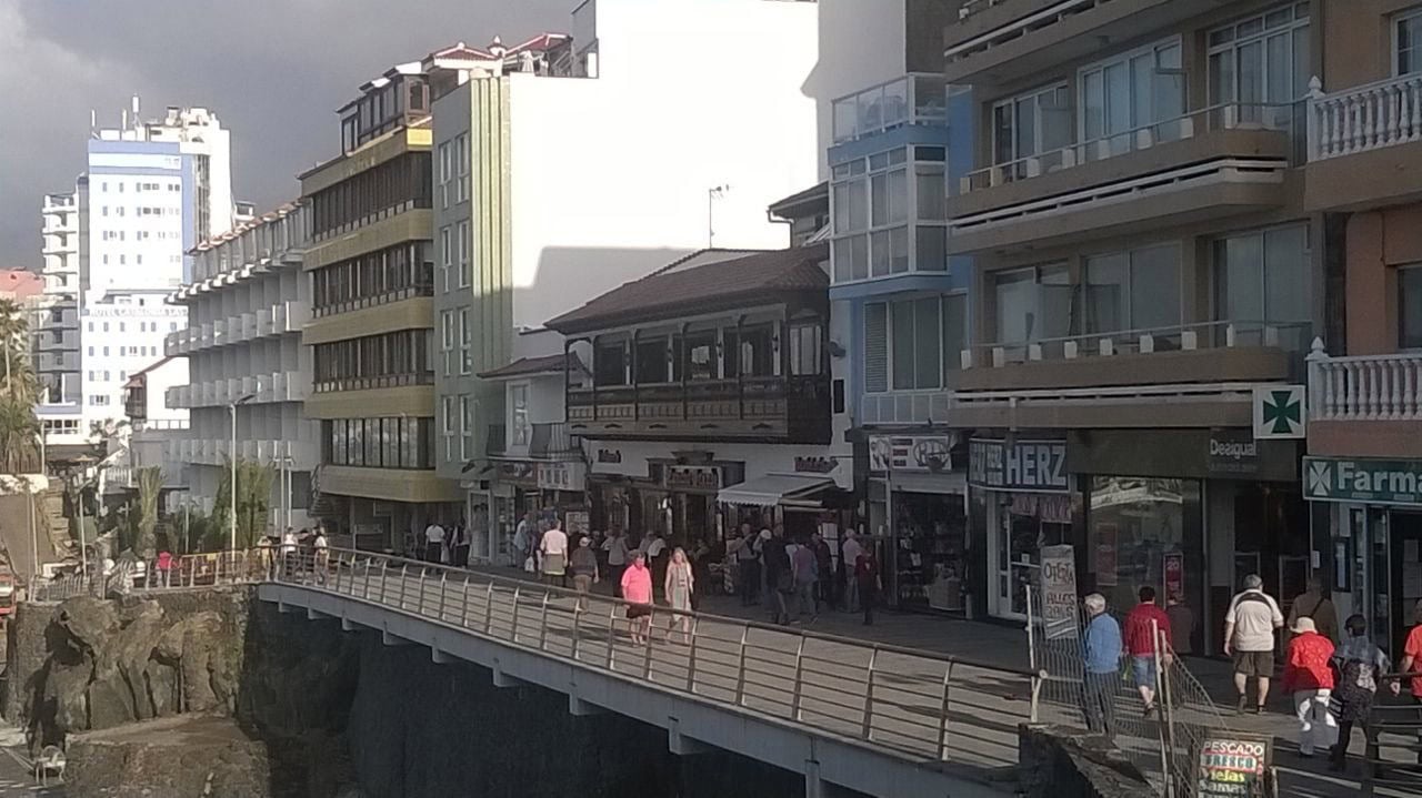
If you walk a few steps further east from the church square, you will reach the spacious promenade of Puerto de la Cruz after about 300 metres. It was completed in 1977 and was modernised for the first time between 2002 and 2005, and again in 2015.
The promenade now runs, with full accessibility, from Playa Martiánez in the east, past numerous long-established hotels, cafés and bars, as well as various souvenir shops and small specialist (electronics) retailers.
Just below the promenade lies the small beach «San Telmo«. It too was refurbished in 2015 and now offers visitors the chance to enjoy a peaceful view of the sea or go for a swim. When the weather is fine, San Telmo Beach can be reached via a path that is also accessible to people with disabilities. However, if the sea is too rough, the beach is closed for safety reasons.
Incidentally, the small beach takes its name from the chapel situated above it. It was named after the Dominican friar San Pedro de Telmo, the patron saint of seafarers.
Lago Martiánez in Puerto de la Cruz
(You can find Lago Martiánez on our map of Puerto de la Cruz under number 10.)
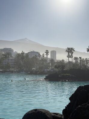
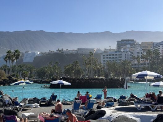
Anyone walking along the promenade is bound to come across one of the town’s most famous attractions. Lago Martiánez is Puerto de la Cruz’s large seawater outdoor swimming pool. It was built in the 1970s to provide Puerto with new attractions as tourism shifted increasingly towards the south of Tenerife.
The grounds are spacious, and thanks to its architecture and water features, the complex feels like a little world of its own on the promenade. For those who don’t fancy lying on the beach, or who find the surf too rough, the outdoor swimming pool offers a more relaxed alternative for a dip and a sunbathe. The swimming pool attracts many visitors, particularly on days when the waves are high.
More information: If you’d like to find out more, you can read our in-depth article here: Lago Martiánez in Puerto de la Cruz.
San Telmo Chapel in Puerto de la Cruz
(You can find San Telmo on our map of Puerto de la Cruz under number 6.)

The San Telmo Chapel was restored in 1968 with the support of the Overseas Secretariat for German-speaking Catholics. Since then, it has also been home to the German parish of Puerto de la Cruz.
The service times at San Telmo are posted. There are also regular parish meetings with special activities at the parish hall ‚Haus Michael‘, near Taoro Park at Calle Las Arenas 42. Further information is available at www.teneriffa-katholisch.de.
Car parks in Puerto de la Cruz
(You can find the large car park on our map of Puerto de la Cruz, marked with the number 7.)

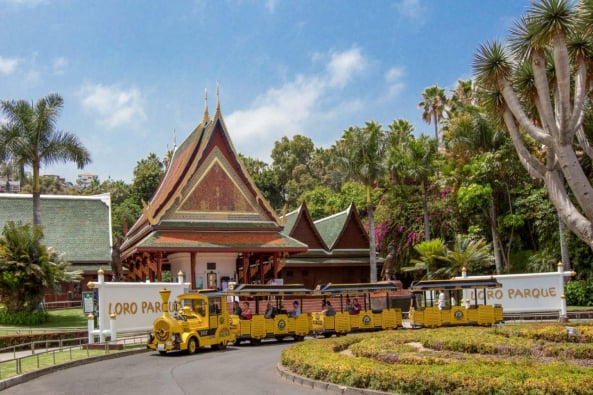
Two of Puerto’s main attractions are situated on the other side of the Plaza del Charco: looking west from there, you’ll find the famous Loro Parque and Playa Jardin. Both attractions can be reached either by heading west through the town or by walking along the large sea wall right out into the Atlantic surf.
The city built this fortification to create a large promenade park, the ‚Futuro Parque Marítimo‘, on land reclaimed from the Atlantic Ocean. However, once the necessary land had been reclaimed, the funds ran out. True to their pragmatic nature, the locals have since been using the area as a large car park. Viewed from the Plaza del Charco, it lies just a few metres seaward. The entrance for cars is situated in the west of the town, near Playa Jardín.
A practical eyesore
Whilst it may be an eyesore for tourists, the car park is a blessing for locals, as the narrow streets of Puerto de la Cruz are no longer designed to cope with today’s volume of traffic and ever-larger cars. During major celebrations and at weekends, when many locals from the surrounding area flock to Puerto, even the large car park is often overflowing.
As a result, the derelict site has now become virtually indispensable, if only for practical reasons. However, it would be desirable to spruce up the car park and clear it of rubbish. In its current state, it is unmistakably der an eyesore for the town.
The new bus station in Puerto de la Cruz
(You can find the bus station on our map of Puerto de la Cruz marked with the number 8.)
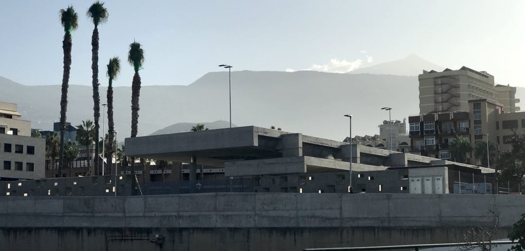
The new bus station in Puerto de la Cruz opened in November 2019. Photo: Ulrike Bornewasser
The very well-developed public bus network is a good alternative to driving, not least because of the lack of parking spaces. Puerto de la Cruz is a hub for numerous bus routes across Tenerife. The town is served by a variety of routes. Many of them start or end in Puerto. Express buses to the airports and to the towns in the south of the Canary Islands that are popular with tourists also stop in Puerto de la Cruz on their way.
From 2009 onwards, the buses were parked on the street above the bus station for ten years. At the time, the building had to be closed due to its dilapidated condition and rebuilt. For a long time, nothing happened and, in typical pragmatic fashion, the ‚Guaguas‘ – as the buses are known in Tenerife – were parked on the street.
The situation did little to help traffic in the centre of Puerto de la Cruz. As no suitable site for the new building had been found even after years of searching, the decision was taken to rebuild the bus station on the same site.
The estimated cost of the project at the time was around 750,000 euros. The budget was later doubled. The new building was eventually handed over to private operators and is to be financed through rental income from car parks, shops, cafés and bars. For a long time – in typical Canary Islands fashion – there was no end in sight to the temporary arrangements. However, in November 2019, the new bus and coach station in Puerto de la Cruz was finally opened after all.
You can find everything you need to know about the bus timetable for Tenerife here, by the way.
The cemetery in Puerto de la Cruz
(You can find the cemetery on our map of Puerto de la Cruz marked with the number 9.)
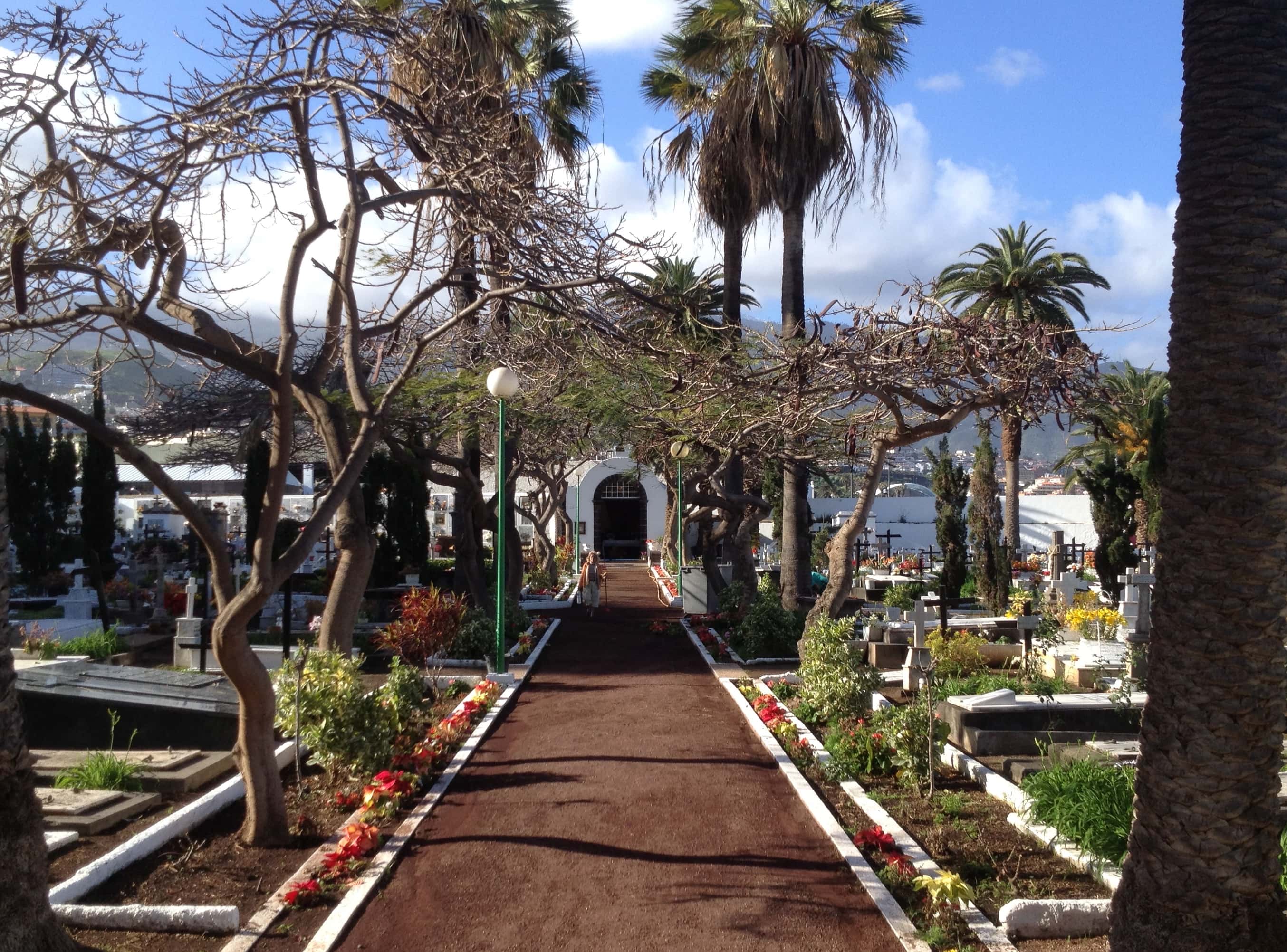
A little further on, just before Playa Jardín, lies the town’s cemetery. ‚La Chercha‘, the cemetery for ’non-believers‘, was opened in 1757, according to the inscription on the entrance gate. However, there are documents suggesting that it already existed some 100 years earlier. The first non-Catholic cemetery on Spanish soil provides a final resting place, particularly for the town’s foreign residents. Until 1810, Catholics were still buried in La Orotava; it was only then that Puerto de la Cruz opened a Catholic cemetery not far away. Today, this is maintained – rather haphazardly – by the town’s British community.
The cemetery offers a mix of ground graves and wall niches. Nestled amongst the high-rise hotels and the promenade leading to Playa Jardín, it is a true haven of tranquillity. Visitors can buy grave candles for a small fee at a florist’s opposite the entrance and light them in the chapel. Behind the chapel are several rows of wall niches. Beyond these lies a small square with a fountain and seating, which invites visitors to stop for a short while.
The beaches of Puerto de la Cruz
- Playa Jardín
- Playa Martiánez
- Playa San Telmo
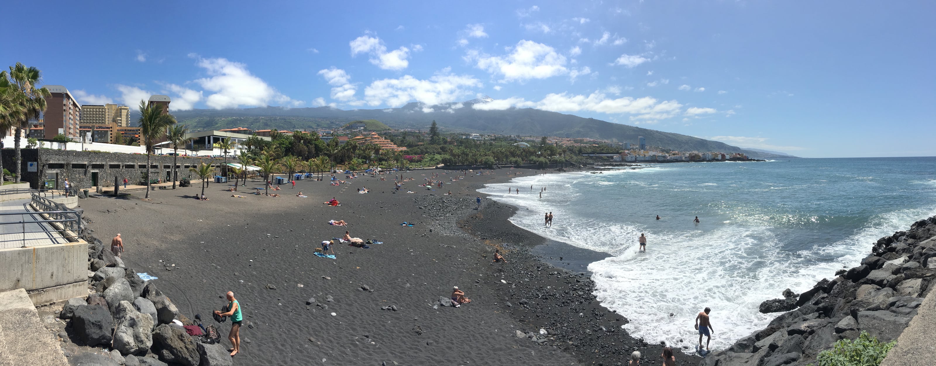
Puerto de la Cruz boasts no fewer than three beaches. There is Playa San Telmo, as described above. In addition, Playa Martiánez, near the large outdoor swimming pool, and Playa Jardín, at the western end of the town, await bathers. You can find all the information on Playa Martiánez here in a separate section, and we’ve also put together detailed information on Playa Jardín here for you.
(You’ll find Playa Martiánez on our map of Puerto de la Cruz marked with the number 11; the neighbouring seawater swimming pool is marked with the number 10. Playa Jardín is located at the very other end of the town, marked with the number 12.)
Puerto de la Cruz in a day
If you’re short on time, you can easily explore many of Puerto de la Cruz’s main attractions on foot. The distances in the old town are short, and many of the best-known spots are close together.
A good place to start is the Plaza del Charco. From there, it’s just a few minutes‘ walk to the harbour and the church square. Afterwards, it’s worth taking a stroll to the promenade and on to the San Telmo Chapel.
If you have time to spare, you can either continue on to Lago Martiánez – from the promenade there’s a wonderful view of the hustle and bustle at the swimming pool – or head towards Taoro Park. From there, you’ll have one of the most beautiful panoramic views of Puerto de la Cruz.
If you’re planning a trip to the beach, you should head to Playa Jardín at the end of the day. The atmosphere there is particularly lovely at sunset.
Events in Puerto de la Cruz

There’s always something going on in Puerto. The various fiestas are undoubtedly among the highlights. The flea market also attracts hundreds of people every Saturday and is well worth a visit.
Restaurants in Puerto de la Cruz
The town offers an enormous variety of culinary delights. From small local restaurants to tapas bars and exotic dishes, right through to vegetarian cuisine, there’s something for everyone. Puerto’s side streets are brimming with culinary delights. Below you’ll find a selection: these are the best restaurants in Puerto de la Cruz.
You’ll also find our restaurant database for Tenerife here. It offers various filter options, such as:
- the best pizza in Puerto de la Cruz
- the best tapas bars in Puerto de la Cruz
- the best restaurants in Puerto de la Cruz
- the best cafés in Puerto de la Cruz
- the best bars in Puerto de la Cruz
and much, much more.
Photos: Everyday art in the cityscape
Important addresses and telephone numbers in and around Puerto de la Cruz
- The emergency number – as everywhere on the island – is 112 (no area code required); the Policia Municipal at Plaza Europa (located between numbers 3 and 4 on the map) can be reached on 092.
- The post office is on Calle del Pozo, near the bus station (number 8 on the map).
- The «Hospiten Bellevue» clinic is on Calle Alemania 6 (near Taoro Park, marked as number 1 on our map).
- You’ll find a German-language bookshop, the «Bücherkiste», in the La Paz district, just before the Botanical Gardens.
Frequently asked questions about Puerto de la Cruz
What are the main attractions in Puerto de la Cruz?
Highlights include Taoro Park, the Plaza del Charco, the harbour, the promenade, San Telmo and the beaches around the town.
How many days should you spend in Puerto de la Cruz?
One to two days are enough to see the main attractions. If you’re planning trips to the Orotava Valley or towards Mount Teide, it’s best to stay longer.
Does Puerto de la Cruz have good beaches?
Puerto has three beaches. However, depending on the weather and wave conditions, they may be closed at times. You can find the descriptions above.
Is Puerto de la Cruz more quiet or more lively?
There’s plenty of activity around the Plaza del Charco. At the same time, there are quiet spots where visitors can take a breather.
More about Puerto de la Cruz

«Puerto de la Cruz Attractions Travel Guide Offers Tips and Advice»
No comments on this article yet.